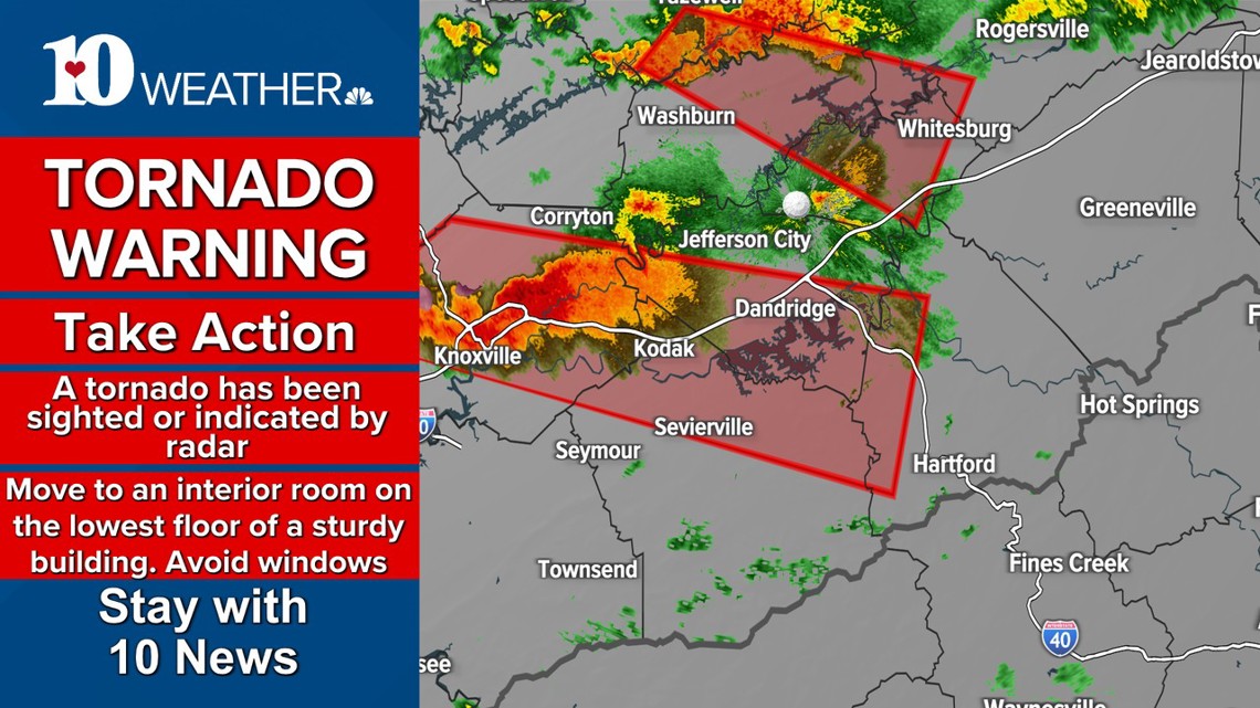
KNOXVILLE, Tenn. — //**A TORNADO WARNING WAS ISSUED FOR KNOX COUNTY UNTIL 9:45 p.m. EASTERN TIME, INCLUDING THE KNOXVILLE METRO AREA.**//
//**A Tornado Warning was issued in East Tennessee for Grainger County, Hamblen County, Hawkins County and Claiborne County until 10 p.m. Another was issued for Hancock County, Knox County, Cocke County, Jefferson County, Anderson County and Sevier County until 9:45 p.m. Eastern Time.**//
//**A Tornado Warning was issued for Lee County in Virginia until 9:30 p.m. Eastern Time.*//
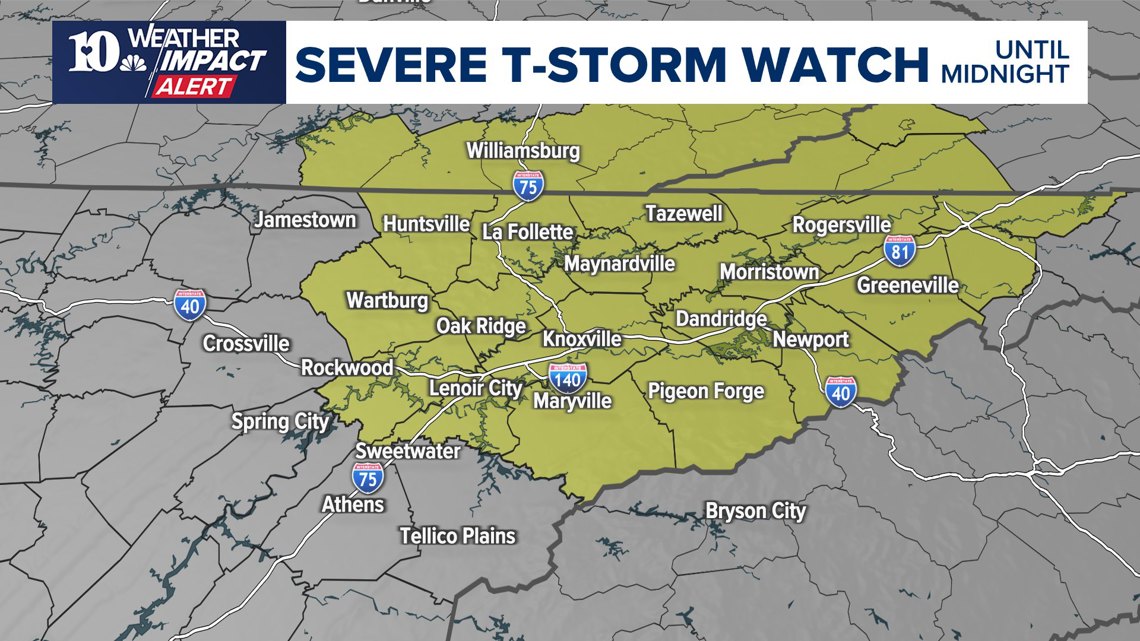
//**A Severe Thunderstorm Watch was issued for most of East Tennessee lasting until 12 a.m. That includes Blount County, Grainger County, Knox County, Campbell County, Hamblen County, Hancock County, Hawkins County, Sevier County, Morgan County, Greene County, Scott County, Jefferson County, Roane County, Cocke County, Loudon County, Anderson County Claiborne County and Union County. It was also issued for Lee County in Virginia.**//


Storms swept through East Tennessee and parts of Kentucky Thursday evening, bringing Tornado Warnings and Severe Thunderstorm Warnings to the region. One storm cell swept through the region over the Deer Lodge, Lancing and Sunbright areas. The National Weather Service said it saw broad rotation in it, and urged people to take shelter.
At around 8:26 p.m. a tornado was confirmed to have caused debris in the Morgan County area between Sunbright and Wartburg in the Lancing area. A storm between Sunbright and Wartburg was moving eastward at around 50 mph, with a high chance for damaging winds. Dispatchers said they saw reports of downed trees and power lines Thursday evening as the storm swept through.
The warning was extended to west and southwest Knox County later Thursday evening, as the storm cell continued traveling.
By 9 p.m., the warning was extended into the Knoxville metropolitan area. A separate Tornado Warning was issued north of the storm until 10 p.m.


ORIGINAL ARTICLE: A cold front was forecast to pass through the region Thursday evening, bringing the chance for showers and storms to East Tennessee.
With warm and muggy conditions in place, there is enough instability for a few of these storms to get feisty.
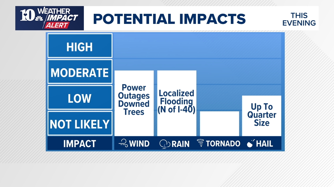
There was a level 1 (green) level 2 (yellow) risk for strong to severe storms Thursday evening.

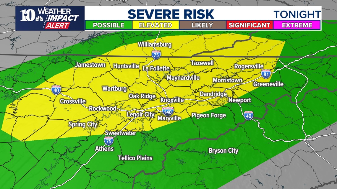
The main threats will be from the potential for damaging wind gusts and hail up to the size of quarters. An isolated tornado is also possible but the chances are low.


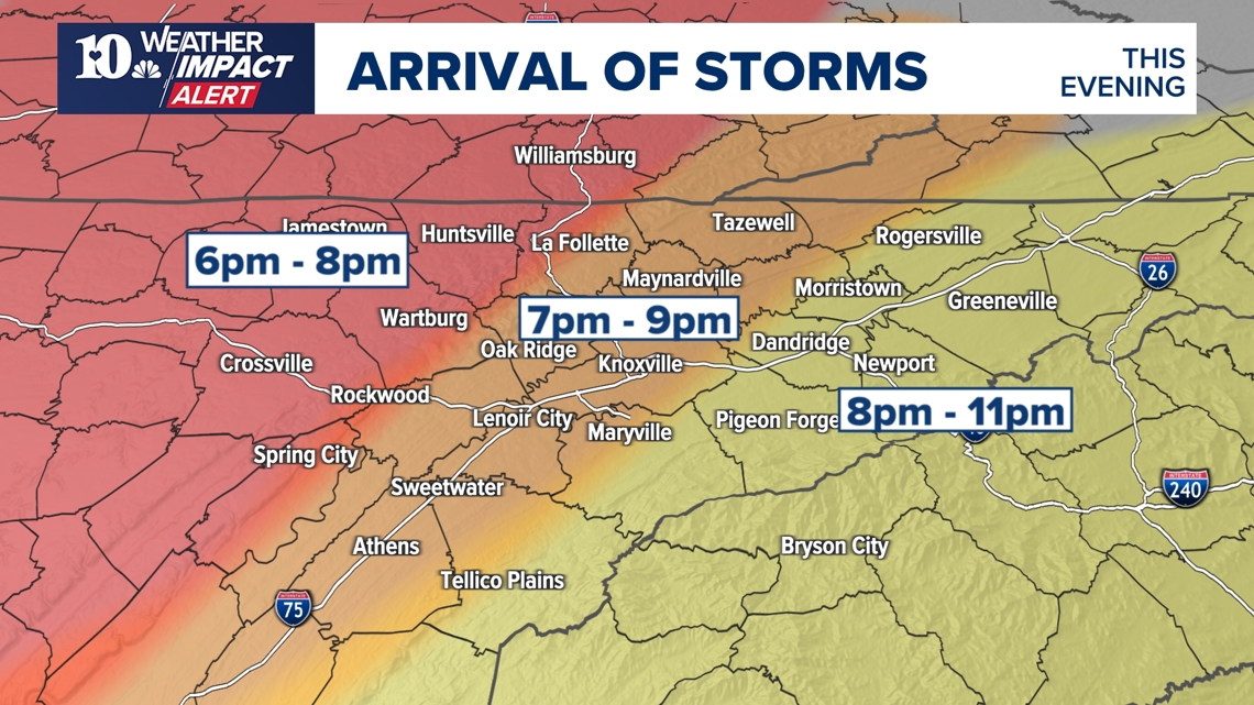
The scattered showers and storms will develop in Middle Tennessee and spread east later this evening.
Below is a timeline for the potential arrival of the storms. The activity should come to an end by around midnight.

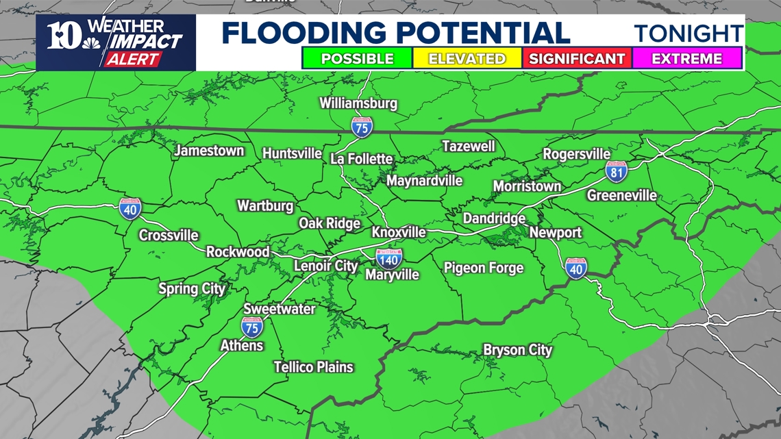
Heavy rain has already fallen in areas north of I-40 over the past few days and with the potential for more heavy downpours tonight, localized flooding will be a growing concern.
Avoid low-lying and poor drainage areas, especially after dark when water on the road is even harder to see.
Never drive through floodwaters!