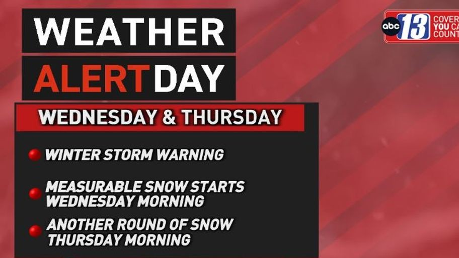
LYNCHBURG, Va. (WSET) — This Wednesday is a Weather Alert Day due to the oncoming snow we’re expecting throughout the entire day.
We’re expecting several inches of snow, with many of us falling in the 2-4 inch range, and higher totals will be seen further east. High temperatures will not break freezing, so brace for a chill on top of the snow.
Tonight a few hit-or-miss snow showers are possible, but most of us should see less snow as it tapers off. The lows will get frosty though, and could drop to the mid or low 20s before sunrise Thursday.
Waking up on Thursday we’ll be much quieter weather wise, but there is another system bringing a quick dash of snow to add to what we’ve already seen.

RELATED: Inches of snow expected on Wednesday across ABC13 viewing area
We could add another inch onto the freshly fallen Wednesday snow, but this system will move out faster. We will be frigid all day though, as wind gusts pick up and kick up to near 30 mph.
This will mean wind chills will be bitterly cold all day, and could drop to the single digits as the sun sets.
The sun will be coming back for the rest of the week and we should also slowly warm up as we get into the weekend. The highs on Friday are more comfortable in the 40s, with lots of sunshine all day.

The weekend looks so much better and warmer, with highs slowly climbing through the 40s and getting to the 50s by early Monday.