by Allen Strum
Tue, March 4th 2025 at 4:45 PM
Updated Wed, March 5th 2025 at 6:09 PM
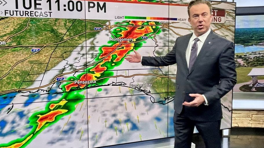
Chief Meteorologist Allen Strum shows the Futurecast model which indicates storms are forecast to strike the WEAR-TV zone late Tuesday night.

WEAR-TV — UPDATE: Tornado Watch for NWFL and SWAL until 1:00 a.m. Wednesday.
A line of severe storms is moving over the South and has a history of damaging winds. The storms will strike the WEAR-TV area late Tuesday night.
The main threat with any storms that become severe will be damaging or straight line winds. The risk for a few tornados cannot be ruled out.
Tuesday morning the National Weather Service in Mobile, AL said, “The forecast remains on track for the potential of severe weather late this afternoon through late tonight, with an Enhanced Risk across much of the local area. Damaging winds (potentially 70+ mph) is the main threat and a few tornadoes (potentially as strong as EF2) are possible.”

The Storm Prediction Center (SPC) has NWFL and SWAL under an “enhanced risk” of severe weather which is a 3 out of 5 on a scale, with 5 being most severe.
A strong south wind is causing dangerous surf conditions for northern Gulf Coast beaches. Red flags are flying to indicate the danger.
A wind advisory is in effect until 12:00 a.m. Wednesday (or late Tuesday night). Winds will be out of the south at 20 to 30 miles per hour (mph) with gusts as high as 45 mph. Breezy weather continues Wednesday but the threat of rain ends late Tuesday night. The weather Wednesday is forecast to be sunny, breezy and a little cooler.