CHICAGO – Chicagoans enjoyed a picture-perfect Tuesday with sunshine and unseasonably warm temperatures, but a major shift in the weather is on the way.
A strong storm system is set to move in Wednesday, bringing the potential for severe weather, including damaging winds, hail, and even a few brief tornadoes.
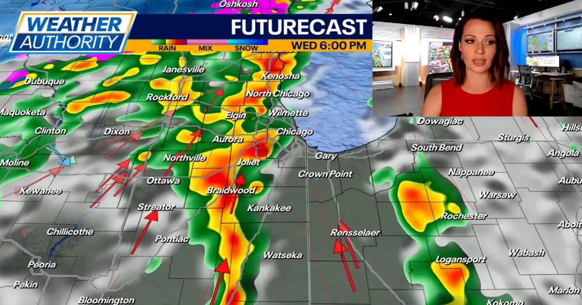
What we know:
Temperatures will remain mild overnight, staying in the low to mid-50s under mostly cloudy skies.

By Wednesday morning, winds will pick up, with gusts reaching 40 mph. Scattered showers and a few thunderstorms are possible early in the day, but the main concern comes in the afternoon and evening.
The Storm Prediction Center has placed most of the Chicago area under a Slight Risk (Level 2 of 5) for severe storms between 3 p.m. and 8 p.m. The primary threats include strong winds and hail, but a brief spin-up tornado cannot be ruled out.
After the storms move through, winds will shift to the northwest, gusting up to 45 mph. As temperatures drop, rain could change over to snow late Wednesday night into early Thursday morning.
What’s next:

Any lingering snow showers should taper off around daybreak Thursday, leaving behind much cooler air. Morning temperatures will be near freezing, with highs struggling to reach the lower 40s in the afternoon.
A brief warm-up returns Friday, with highs in the mid-50s under partly sunny skies. A few isolated showers are possible in the evening.
The weekend will bring dry weather on Saturday with highs in the mid-40s, while Sunday could see occasional showers and temperatures near 50 degrees.