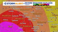
Good Saturday. Today is a Storm Alert Weather Day across our entire viewing area. Two rounds of storms will impact our area.

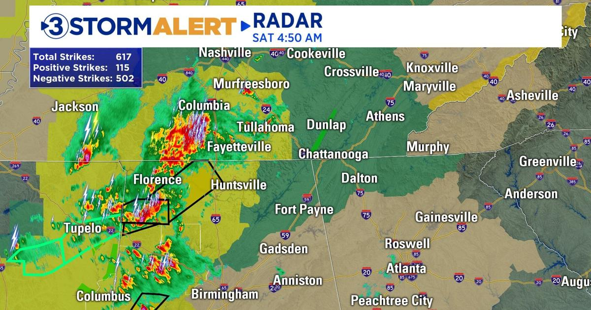
Round 1: Will impact many from around 7 am to 1 pm. Heavy rain and thunderstorms will be possible producing hail and gusty winds west of Chattanooga moving SW to NE along the Cumberland Plateau and Sequatchie Valley.
Between 1 pm-5 pm: Dry weather will allow temps to climb to (74 in Chatt) and the atmosphere to destabilize. Many viewers, especially in our eastern viewing area, likely won’t see a drop of rain until round 2 moves through this evening/overnight. Even though conditions will be “good” during the day for these locations, tonight’s storms will pack a punch.
Round 2: Strong to severe thunderstorms capable of producing heavy rain, lightning, damaging wind gusts, and tornadoes will move across the Tennessee Valley from west to east between 6 pm-3 am.

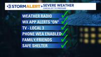
NOW is the time to prepare! There are several ways to receive severe weather alerts. Download the Local 3 Weather app and turn phone notifications ON.
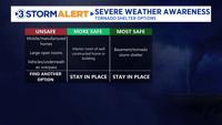
Know where your safe place is. A basement is the safest location in the event of a tornado warning. If you live in an apartment complex, the first floor is the safest place. If you live a few floors up, now is a good time to get cozy with your first-floor neighbors. If that isn’t an option. Choose the most interior space inside your apartment. This will be somewhere like a bathroom or an interior closet away from windows. Campers and trailers are not safe spaces during tornado warnings.
Now is the time to download the Local 3 Weather app.